|
Source: waymarking.com
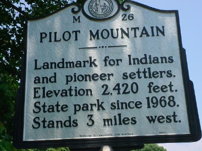
M-26  Driving on US-52 between Mt. Airy and Winston-Salem, it's impossible to miss this mountain looming above you! N 36° 20.567 W 080° 27.683 Description: Pilot Mountain has a long history, which includes private ownership, and finally as a N.C. State Park. There is a paved road to a parking lot, restrooms, and trails to overlooks with dramatic views. The historic marker is at the park entrance. There is a benchmark in a traffic island about 200 feet from the marker, and two benchmarks near the parking lot on top of the mountain. Visitor Information. Open during daylight hours. There is an information center near the base of the mountain, along the road to the summit. Trail maps are available. Soft drink machines and restrooms at the center and summit. Drinking fountains both places. Trails to lookouts are moderately steep with some rock steps. However, excellent views are available at the south end of the parking lot, and this area is accessible for individuals with limited mobility. No admission fee.
This page was last updated October 17, 2010. © 1997-2010 by the Surry County
Coordinator |
